From Raw Imagery to
Reliable Models in Hours

From Raw Imagery to Reliable Models in Hours

MetaVI eliminates the AI bottleneck.
We provide a complete, no-code life cycle that empowers analysts to
build mission-specific detection models with full autonomy.

Operational Autonomy in 4 Stages

A streamlined no-code lifecycle designed for Geospatial Analysts.

1-annotate
Annotate & Build

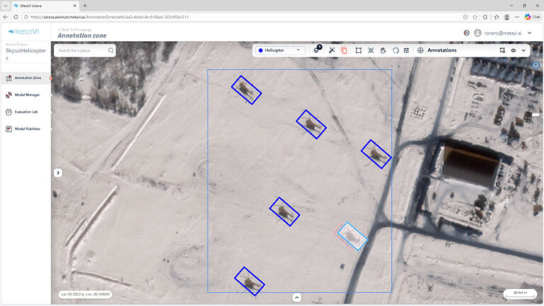
Stop manual labeling of thousands of images. Smart one-click labeling makes annotation fast and effortless, supporting multiple users working simultaneously.

Built for the Analyst

Reach operational reliability in hours. Meta-learning architecture allows you to create trusted profiles with just a handful of training samples.

01.
2-Evaluate
Evaluate & Optimize
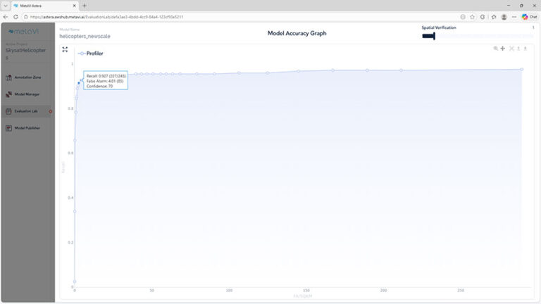
Trust comes from transparency. The Strategic Dashboard provides deep geographic insights, allowing you to manage samples and view performance stats tailored for real-world field use.
Sensor Ready
Validated high accuracy on challenging satellite resolutions and diverse sensors (EO) where standard AI fails.
02.
3-deployandrun
Deploy & Run

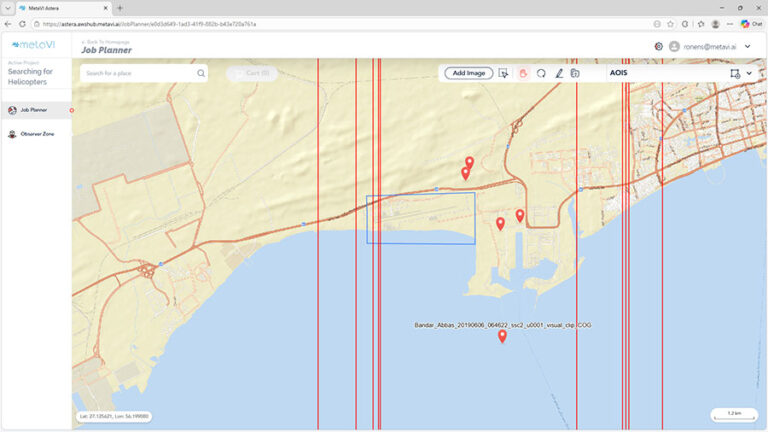
Immediate operational impact. Process vast areas (Thousands of sq km/h) by deploying your profile as a plugin or standalone tool.

03.
Run-&-Observe
Observe & Improve

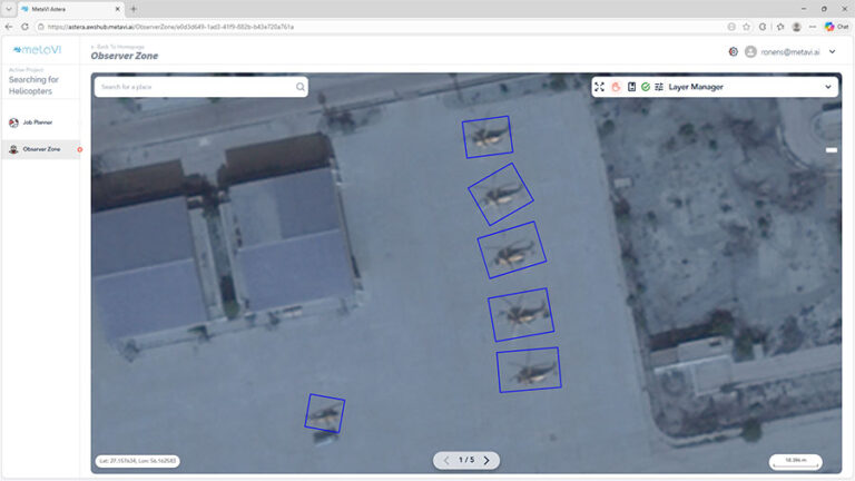
Every mission makes the system smarter. Analyst-validated results are instantly fed back into the learning loop, refining the model for terrain, seasonal, and sensor variations.

Operational Integrity:
Full end-to-end autonomy in restricted, air-gapped environments. Your data never leaves your perimeter.

04.
Field -Proven Performance

Real-world results achieved by analysts using MetaVI across diverse targets and sensors.

Things you need to know

Frequently Asked Questions

How does the feedback loop work?
MetaVI supports a continuous AI lifecycle built around six steps: Annotate, Build, Evaluate, Deploy, Run, and Observe. Analysts begin by annotating imagery using smart one-click labeling, then build models with MetaVI’s AI engines, which are optimized for aerial and satellite imagery. Models are evaluated, tuned, and improved through analyst feedback, creating a continuous training loop that helps adapt them to new targets, areas, and mission needs.
 
Once deployed, models can be run at scale on large volumes of geospatial data, across multiple AOIs, images, and operational workflows. In the Observe stage, multiple models can be used to review, validate, prioritize, and manage ranked results, helping teams generate mission-relevant insights from large-scale geospatial data.
Can MetaVI process imagery from multiple satellites and sensors?

Yes. MetaVI is designed to work with geospatial imagery from multiple sources, including satellite, aerial, and other sensor platforms. This allows organizations to build and deploy models across different image providers, resolutions, and collection conditions, improving robustness in real operational environments.

Does MetaVI require a cloud connection?

No. MetaVI supports flexible deployment options, including cloud, on-premise, and secure air-gapped environments. Organizations can run the system entirely within their own infrastructure, making it well suited for defense, intelligence, and other security-sensitive use cases.

How many examples are needed to train a reliable model?

MetaVI is built to dramatically reduce the amount of training data required. In many cases, effective models can be created from a relatively small number of examples, typically from dozens to a few hundred, depending on the mission. The exact number depends on the target type, image quality, scene complexity, and required operational accuracy. MetaVI accelerates this process through smart labeling, intelligent sample selection, and automated model optimization.

What processing speed can I expect?

MetaVI is designed for high-throughput processing of large-scale aerial and satellite imagery. The system is built to support parallel computing, allowing processing capacity to scale according to the available hardware and deployment configuration. In practice, the more processing power allocated, the more the system can scale to support larger data volumes and faster turnaround times.
With a standard operational hardware setup, MetaVI can process thousands of square kilometers per hour, while scaling further as additional processing resources are allocated.

Do I need specialized AI expertise to use MetaVI?
No. MetaVI is designed so that operational analysts can create, train, test, and deploy models without deep AI expertise or coding skills. The platform provides a fully no-code workflow, enabling users to build operation

רוצים להתייעץ?

מלאו את הפרטים ואחזור אליכם בהקדם.
או בטלפון +1 (703) 879-0060